Catching Up: Tomas, Snow, Links, Climate Change, Hail Video

It’s been a busy few days on this end…family, weddings, etc., so the blog needed a few days off! Let’s catch up on some links and info.

– Tomas hit Haiti, but fortunately it seems that nation was spared the worst of a natural disaster for a change. Still, it didn’t help matters, and I don’t think the post-storm conditions are exactly desirable, but as I understand it, the death toll was limited to eight, which is great news considering how vulnerable that island is right now.

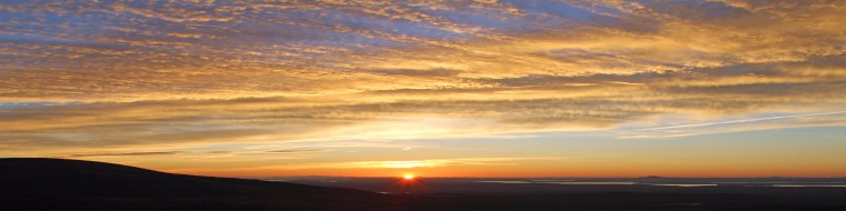
As a wrap, here’s some cool imagery from Tomas.


GOES-13 Water Vapor Imagery of East Coast Early Season Winter Storm, courtesy of CIMSS: http://cimss.ssec.wisc.edu/goes/blog/archives/7128


Winter Arrives

Tomas also provided some impetus for additional moisture in the storm that brought a surprise snow to parts of New England, New York, Long Island, and even parts of New Jersey today. Alright, it wasn’t technically a surprise, but I think the intensity and amount of it was. Cool image to the right is of the storm from the GOES-13 satellite…you can see the moisture feeding in on the eastern flank of the storm from the former Tomas. So this was a potent system that brought the first real accumulating snow to parts of the Northeast.

The Albany, NY area really cashed in with an average of 1-3″ of snow in and around the immediate Capital District. Parts of the Catskills ended up with 1-4″. Parts of Long Island received about 0.5″, and southwest Connecticut had about 0.5-1.5″. Much of interior New England saw 0.5-2.5″ of snow, widely varying from place to place. So winter is unofficially underway. This was not an easy storm to forecast, as the models were not quite on their A-game, and you’re dealing with a very anomalously strong storm. The combination allowed this to portray the element of surprise for a lot of people west and south of New England.

Keeping on the theme of winter, the first real lake effect snow event of the season for parts of the snow belts downwind of Lake Michigan kicked off over the weekend. Anywhere from 3-5″ of snow fell in parts of Indiana. Lake effect season is certainly underway.

And just to add on, last week’s system provided snow for parts of the South! The Great Smoky Mountains ended up with a fair amount of the white stuff.

More Links

In New Orleans, more issues regarding the levee system. This time, they want to ensure that the modeling that was done in the disaster projections was done properly. Obviously, when you’re dealing with billions of dollars in construction, you want to make sure all the I-s are dotted.

Invisible, ancient galaxies are brought to light, thanks to Einstein’s trick (gravitational lensing)! Pretty cool, as these are things even the Hubble Telescope wouldn’t be able to capture.

I don’t claim to be a volcanologist, but the amount of activity that’s gradually been building in Indonesia (in addition to earlier activity in Iceland) is intriguing. Indonesia is a powder keg though, given that it’s on the Ring of Fire in the Pacific. The latest addition to the building activity (aside from Merapi) is the new dome that built up on Krakatoa since its 1883 super eruption. Andy Revkin’s DotEarth blog has an interesting feature on a “volcano chaser.” It also has some cool volcano video.

Global Warming Fight

Some interesting articles on global warming are popping up. Since Election Day, this whole simmering battle may come to a boil over the next two years, with climate scientists possibly getting more involved in advocating policy than ever before.

Straight off the bat, the climate science community and American Geophysical Union originally came out they’re ready to fight. But they later struck a more conciliatory tone. This may just be another example of hyperbole in the media, but I think it makes a point.

In other news, the Chicago Climate Exchange is axing its cap and trade program. This is a good thing in my own personal opinion. Whether you are in favor of strict caps on carbon, or you could care less, cap and trade will not solve anything in my opinion. It doesn’t cut emissions…it keeps a cap on what already exists, which if it is causing problems, isn’t going to help things.

California may be the pioneer in alternative and new energy, but Texas is the pioneer in fighting the EPA. This furthers the battle I mentioned above.

Lastly, a pretty good blog entry from a meteorologist at WAOW in Wisconsin regarding some more of this hard line being drawn in the global warming fight.

Just a pause here for a moment for my own $0.02… this is all somewhat disturbing to see. Getting lost in this mess is actual sound climate science. And both sides are to blame in my own opinion. I think Congressional Republicans do have a right and probably a duty, given the election results, to question some of the science and actions related to the science….within reason. I think scientists have the right and the duty to defend their work. Unfortunately the line between science and policy has been blurred, and people who aren’t qualified to speak on either side of the issue are crossing lines they aren’t supposed to be crossing. In my opinion, the scientists need to be sticking to science (on both sides) and defense of their work. The policymakers need to stick to policy. In between, there should be people keeping scientists honest, keeping politicians honest, and keeping each group out of the areas they don’t belong in. It’s become too politicized (it was years ago), but now with this congressional takeover, I fear that this is going to get blown into something that will not have either group looking good in the end.

Video

Lastly, some cool video of a hailstorm in Georgia!

Fun With Radar + Latest on Tomas and More

I’ve had this post brewing awhile, but I was inspired today by a friend’s photos on Facebook. I want to show you a couple cool radar images from the last couple weeks, from the Weather Underground weather website. Radar is obviously primarily used to track precipitation and thunderstorms. But, it can also be used to find hail cores in thunderstorms, areas of rotation in thunderstorms that may be producing tornadoes, rain/snow lines, areas of gusty winds, birds, and more!

Well, a couple recent examples of cool stuff you can see on radar.

Radar Loop from San Francisco Bay Area, credit: Weather Underground

If you click the map to the left, it will open up a radar loop from the San Francisco Bay Area that I caught a couple weeks ago. It was generally a quiet day, with just some showers offshore. But, if you look at the image, you’ll see a couple stationary areas, which, if you didn’t know better, you might assume are thunderstorms. Those areas are west of Modesto and south of Sacramento. Well, we know that it was a quiet morning, so it wasn’t a thunderstorm. So what’s going on?

Well, if you know about that area, there’s a gigantic wind farm in Altamont Pass. It’s the largest concentration of wind turbines in the world, with a capacity of 576 MW…through 4,900 turbines! So it’s huge. The other large wind farm there is north of that little lake: Shiloh Wind Power Plant. Smaller, with 300 MW of capacity and about 175 turbines. So what happens with radar in simple terms: The radar emits an electromagnetic beam, which will reflect off of objects and bounce bank to the radar, producing a pixel at the location where the beam bounced from. The radar almost always aims upward (so it doesn’t bounce off of ground level objects and can “look” into the clouds, where the rain/snow falls), so if there are any objects in the line of sight, they will reflect back a pixel. Given the location of the radar, just south of Sacramento, and assuming the line of sight is higher up…but not too terribly high (the radar beam was probably aimed low to look for patchy drizzle this morning), it’s obvious that the radar is picking up the turbines at those wind farms. The radar beam is hitting the rotating turbine, and firing back to the computer that “something” is there. That something is the wind turbine.

A lot of good, easy to understand information is here from the NWS Milwaukee, in a case study on their Butler Ridge wind farm.

More technical details are here…a website from the NWS explaining the issues with wind turbines and radar.

Example II

Radar loop from Fort Dix, NJ, zoomed in on Raritan Bay, credit: Weather Underground

This afternoon, there’s a fairly large brush fire burning near Edison, NJ. Well, in addition to picking up a lot of the other cool things I talked about above, radar can also detect smoke from large fires. If you look the image at right, you’ll see a great example of this happening…as the fire grows and the smoke plume rises, you can see it on radar. Essentially, the same process is at work. The radar beam is looking up into the clouds and instead of seeing a wind turbine, now it’s seeing (the many) particles contained within the smoke. We see this a lot.

Occasionally these fire plumes can put off enough heat to help clouds actually form above the fire, often in the smoke plume, called pyrocumulus clouds. These essentially are formed by the same process that forms thunderstorms, and like those, they can occasionally have lightning too. I do have a few photos from last year’s massive Station Fire near LA on Flickr here. More on that another time though.

Here’s a link with more ways radar can be interfered with…from the NWS Milwaukee, which seems to be a treasure trove of cool links.

So there’s some of the “fun” we can have with radar.

Hitting the Links

Here are some links I’ve encountered the last few days.

Ahead of the impending disaster likely from Tomas, Haiti is trying to get refugees from the earthquake as far out of harm’s way as is humanly possible. Tomas does not appear to be as big of a threat in terms of wind potential. However, it is equally as disheartening to watch as I warned you over the weekend from a rain potential. Tomas nearly fell apart this morning, as it was downgraded to a tropical depression. It has since restrengthened into a 45 mph tropical storm. The good news is that, as previously mentioned, everything got to this storm and it will likely NOT reintensify into a major storm. The bad news is that it’s still going for Haiti, and they should expect 5-10″ of rain, with upwards of 15″ possible in favorable upslope areas. Just a terrible situation. Stay tuned on this.

A trio of links for folks in the Mid Atlantic…

Part II of Wes Junker’s detailed analysis of last winter’s record snow in Baltimore/DC and surrounding areas from the Capital Weather Gang.

An article that claims last winter could have been far colder, possibly prevented by global warming!

Visualizing just how much snow fell last winter in the Mid Atlantic.

And lastly, Minnesota set a record for most tornadoes in a year in 2010.

Go Rutgers tonight…beat USF!

Tomas & Haiti? Plus Storm, Heat, and MeteoPolitics!

Wind shear and 24 hour change in the Atlantic Basin, credit: University of Wisconsin CIMMS

Tomas continues along in the Caribbean today, about 265 miles west of St. Lucia, chugging off slightly north of due west around 10 mph. Tomas bumped up to a Cat 2 storm overnight, but has since weakened, back to a minimal 75 mph category one storm. Reconnaissance aircraft visited the storm earlier and helped quantify what satellite had been showing all day. It looks pretty ragged, as some dry air and shear have begun to take their toll on Tomas. You can see  the ragged structure of Tomas here. The darker area to the west of the storm indicates the presence of at least some drier air too. The image to the left shows the current wind shear analysis in the Atlantic, as well as the trend. The red area near the hurricane symbol indicates that Tomas is in an area of enhanced shear. Assuming things gradually progress from west to east, it would appear things are only going to get more hostile for Tomas the next day or so. In fact, the model guidance suggests that the shear remains over Tomas into Tuesday, before pulling away. Provided Tomas can maintain its core and overall structure, even if it weakens into, say, a tropical storm, it will have an opportunity later Tuesday and through Wednesday to intensify, and given the water temperatures in that region, it could be explosive strengthening if the conditions are right.

In terms of the track of Tomas, while things may change some in the next day or two as the storm fluctuates in intensity,

Morning Model Guidance Spaghetti Plot of Tomas' Tracks, credit: South Florida Water Management District

you can see that most of the models track Tomas to just south of Hispaniola. After that, they generally either stall or it lift it northward. In reality, given the normal uncertainty of tropical systems, anything is possible, from Cuba to east of the Dominican Republica. Unfortunately though, Haiti looks to be right in the middle of the possibilities. And again, unfortunately, regardless of the intensity of Tomas at landfall, this is really looking like it could be a very grim situation for that country, and if you thought things couldn’t get worse in Haiti, this would be how it can. Current model projections (which generally do a poor job handling specifics of tropical system precipitation totals) are dropping 8-10″ on southern Haiti. This is really a disheartening situation to watch, and hopefully precautions are already being taken to ensure the safety of residents and relief workers.

Elsewhere…

Still watching this storm for next week. In my forecasting for California next week, it was pretty obvious the differences in the main models (Euro and GFS). The GFS cuts down the western ridge and slides it to the Lee of the Rockies on Friday/Saturday, which has almost no support from any other model or its own ensemble members.

Euro Depiction of a Mess in the East, credit: Allan Huffman's Weather Model Page: http://raleighwx.easternuswx.com/

So what it’s doing is forcing everything in the east to develop further east, and therefore not as amplified. The Euro however last night took a deeper low out of the gulf and up the Appalachians into Western NY, wrapping the possibility of at least a few inches of snow on the backside for much of the mountains of Tennessee/North Carolina, up through West Virginia, eastern Ohio, western PA, Michigan, and western NY and Ontario, along with some lake effect or lake enhanced snow on the wrap around. The European has some support from the Canadian model (which is taking a 980 mb landbomb from the Carolinas northwest into OH/IN), which is also encouraging for confidence. This morning’s verison of the Euro was a little further east, and brought the chances for snow from the mountains of NC/TN up through WV’s mountains, and perhaps some in W PA and Eastern Ohio/Western NY, as well as Ontario and northern Michigan. It has to hit a fairly narrow window for snow, but if I had to place bets right now, I’d lean on Ontario/Michigan and not much more than that at the moment. Stay tuned.

Election Day Weather

With the big midterm elections coming up, there are all sorts of anecdotes about weather and people’s voting habits. Well, we’ll test the theory again this year, but primarily in the south. It looks like areas from Houston to New Orleans up through Mississippi and into Memphis and over to Little Rock will see the worst weather in the US on Election Day (as the late week storm begins to develop). Otherwise, other than a couple showers in the Northwest and parts of Minnesota it looks dry. So no excuses to stay home…go vote.

Cali Heat

I discussed how the European model keeps the western ridge in tact. Well that ridge is going to lead to searing autumn heat in California, with Santa Ana winds possibly leading to temperatures into the mid or upper 90s here in SoCal. It looks blazing hot Tuesday and Wednesday. Tuesday’s record high for Downtown LA is 99 degrees, and Wednesday’s is 95 degrees. Tuesday’s looks a lot safer than Wednesday’s at the moment. I suspect we could be talking record heat for a day or two in parts of SoCal. Been a year of some ridiculous temperature extremes out here.


Twin Tropical Trouble + Latest on Next Week

European Model Surface Plots (Left: Thursday morning, Right: Friday morning), From PSU E-Wall.

Not too much to add this afternoon on next week’s eastern system. There are still glaring differences between the models. The European model continues to go all bomb’s away off the East Coast. The GFS model continues to be flat..dumps some pretty chilly air in, but no storm. I continue to side with the Euro for the most part on this, with maybe not as much of an explosive system to develop later next week. Check this out. The European model (images above) takes the storm from about a 1008 mb weak low on the Carolina coast Thursday morning to a 972 mb beast in Central Maine on Friday morning. One key change with the European model today though is that it is not flinging quite as much moisture back into the cold air on the west side of the storm. This would spell less snow, except perhaps for the higher terrain of Northern New England (which would be hammered if the European model is correct).

So the take home message today is that, there’s still a chance for a pretty interesting storm. There’s a chance snow will be involved in some interior sections. There’s also a slight chance we could be dealing with another bomb cyclone, which could potentially cause significant weather impacts in parts of Northern New England and Quebec. So stay tuned…these sorts of battles aren’t uncommon between the two models. This will be a good test for the upcoming winter. Sometimes if a model shows a radical solution (like the Euro) and ends up correct, you can occasionally give that model some extra confidence through the winter season. In a tough situation, sometimes that can pay off huge if you’re a forecaster. So we will see.

In other news….

Model Spaghetti plot of tracks for Tropical Storm Shary, from South Florida Water Management District

The National Hurricane Center has started issuing advisories on two new tropical systems in the last 24 hours: Shary and Tomas. This brings the 2010 Atlantic Hurricane Season tally to: 19 named storms, 10 hurricanes, and 5 major hurricanes. Normal is 11/6/2 I believe. So we’re long gone in terms of normal.

So what about these two storms? Shary is more of a nuisance than anything. Expecting a mid-grade tropical storm (current winds 60 mph) that will bring gusty winds and locally heavy rain to Bermuda. Then it should scoot out to sea.

Tomas, on the other hand, has a potentially much more sinister future ahead. Tomas just formed, so its winds are only 40 mph, and it will scoot along in the Caribbean, likely not impacting anyone through the weekend (except perhaps some cruises or some outer rain bands/gusty winds on some of the islands). But Tomas is headed into an area of very favorable ocean and environmental conditions for development.

Model Spaghetti plot of tracks for Tropical Storm Tomas from South Florida Water Management District

The latest image from the LSU Earth Scan Lab shows a whole lotta red in the Caribbean. This spells development if the environmental conditions are right. And it appears they will be as we go into next week. The official track of Tomas from the NHC shows it becoming a major hurricane next week as it begins to turn north toward, sadly, Haiti. If there is one place in the Atlantic Basin that could really use a season without a direct impact from a storm, it’s Haiti. Still a long way to go, but this could very well shape up to be a devastating storm for someone. We’ll see.

More Power/Less Power

Some renewable energy news to close things out.

California is fast tracking several big time solar plants to get in before a critical deadline.

Wind power, however, has slowed down considerably, back to 2007 levels. I do think wind will pick back up with the economy though.

More later…