Good news and bad news if you’re an eastern snow lover today. The good news is that the ability for snow to fall because of cold weather looks to stick around for awhile. This morning’s model runs look quite cold for the Eastern US, and blazing warm for the West over the next 10 days or so. And it looks like at least some lighter snows will fall over a fairly large area for the end of this week. However, the bad news… this morning’s model runs did no one any favors regarding the potential for a significant storm early next week. The top map is the European model forecast…the bottom is the GFS, valid through the day Sunday (All model maps from Allan Huffman’s site here). You can see from both of these models, the center of the low…still a strong one…is pretty far inland. This absolutely crushes parts of the interior, specifically Ohio, NW Pennsylvania, Western NY, and Ontario. The Euro is even further west today, hitting Wisconsin, Michigan, and Central Ontario hard. Again, this does not mean that this is now a dead issue. But, this is modestly decent agreement, and there’s reason for me to think the threat further east (specifically east of I-81) is fairly limited.
If you look at the maps to the right, these are the 500 mb maps (slices of the atmosphere about 20,000 feet up) for the same time periods as above. Remember, things in the atmosphere move in waves with ridges and troughs. For a big eastern storm, you usually need a big ridge in the West and a big trough in the East. That exists here. But it’s the orientation that’s key. If you look at the Euro (top), the axis, or center of the ridge, is located through Portland and Seattle. If you look at the GFS (bottom), the ridge axis is along the Idaho border with Washington and Oregon. For a really good storm to impact areas east of I-81 to the big cities, you really need this ridge axis to set up around Boise, ID. If you notice, the GFS is a lot closer to a decent storm than the Euro (which wacks areas way far away from most of the Eastern cities)…and it’s no coincidence that the ridge axis on the GFS is a good 300-400 miles further east than the Euro.
Keep an eye on this in the coming days because this isn’t a slam dunk, as the operational models are not in lockstep with their ensembles, as has often been the case this autumn/winter…and in fact those show the potential for a further east tracking storm. So today wasn’t a great day of runs for snow lovers east of I-81, but this is by no means a dead issue.
Hey, lastly, cool video of the day for you… the entire 2010 Atlantic Hurricane season looping by on satellite. See all 19 storms go by (don’t blink, you might miss some!):
Well, I hope everyone enjoyed their Thanksgiving and holiday weekend, did their shopping, etc. Back in California after a fun leg of flights today over the large storm system swirling in the middle of the country. More on that shortly. First, let’s catch up on some of the more interesting stories from the last week or so…
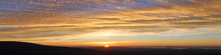
2010 Atlantic Hurricane Season Storm Tracks - courtesy NOAA
2010 Atlantic Hurricane Season Ends
First and foremost, today is November 30th, which is the last day of the Atlantic Hurricane season. That isn’t to say more storms can’t form, but in terms of statistics, this season is done. How did we do?
19 Named Storms
12 Hurricanes
5 Major (Cat 3+) Hurricanes
Normal is 11, 6 and 2 respectively. Here’s the official NOAA press release on the season. The season ends up tied for the 3rd most active on record (1887, 1995), and it ties for the second most hurricanes on record (1969). The money quote from the release (in my opinion):
“Large-scale climate features strongly influenced this year’s hurricane activity, as they often do. This year, record warm Atlantic waters, combined with the favorable winds coming off Africa and weak wind shear aided by La Niña energized developing storms. The 2010 season continues the string of active hurricane seasons that began in 1995.
But short-term weather patterns dictate where storms actually travel and in many cases this season, that was away from the United States. The jet stream’s position contributed to warm and dry conditions in the eastern U.S. and acted as a barrier that kept many storms over open water. Also, because many storms formed in the extreme eastern Atlantic, they re-curved back out to sea without threatening land.”
Overall, I think this season is going to go down in the books as a bust in general, namely because the U.S. was spared a hurricane hit for the fifth straight year, despite the hyperactive nature of the season. But the forecasts were very well done for the most part this season, and frankly, I don’t know that you can ask for much more than that, given our limited ability to predict weather and climate.
So what about next year? It’s obviously way down the line and there’s little skill in trying to make a forecast this far out. But, if you look at a couple of key El Nino area forecast, the ECMWF and the IRI, both indicate (an implied and/or average) weak La Nina persisting into next summer. Should that hold together, that would be one factor that would would favor another busier than normal season. Whether it’s even remotely as busy as this year…or busy at all…remains to be seen though. But that just gives you an idea.
Lastly with the tropics, some new online maps are available, indicating flood vulnerability along the coast due to storm surge. If you click the link in the article and tool around with the maps, some of them are interesting. Bottom line, there are a LOT of vulnerable places on this country’s coast to storm surge flooding.
Some cool video came out of last week’s big Western storm. This video was courtesy of Dale Ireland in Silverdale, WA (originally published in Cliff Mass’ Washington weather blog). Then of course, there was this priceless video from Seattle last week:
Here’s a radar loop from the snow in Seattle last week as well:
That Seattle snow made it to Salt Lake City last Tuesday, and here’s some really cool time lapse video of the snow rolling in, and a slower video that shows basically a wall of angry weather arriving:
Interesting AccuWeather blog post today about how the West is seeing absolutely phenomenal early season ski conditions…some of the best in years. It has been stormy…and it’s also been cold, helping a lot of ski resorts add more white gold to their slopes. Absolutely great conditions out West this year. Here’s an article on how citrus growers in Central California have been protecting their crops.
Cold in Europe
This winter is behaving (in some regards) oddly similarly to last winter. If you remember last winter, the US and Europe had it especially rough. Well, Europe is off to the races this winter too.
The Eastern US will taste some cold weather, sort of driven by similar factors (and relatively, not nearly as cold) as we go through the next ten days or so. The pattern will also be ripe for the potential for at least some snow. More on that in coming days.
A few final things today.
USGS "Did You Feel It?" Map from today's 3.9 magnitude earthquake off Long Island.
A 3.9 magnitude earthquake occurred around 10:45 AM today, about 120 miles ESE of New York City. The details on the quake are here. A ton of “Did You Feel It?” reports were received by the USGS from Long Island, New England, and New Jersey. Anyone notice this today?
And finally, in what is the most painful story of the day, another tornado hit Yazoo City, MS this morning. If you recall, Yazoo City was hit by a devastating EF-4 tornado back in April that killed 10 and injured dozens. From what I’ve read thus far, there were six injuries from this morning’s storm. More details if I get them.
More on some of the upcoming weather in the next couple days as I get myself caught back up on things after the extended weekend.
The picture at left represents the best I could do after midnight to capture lightning. Tough around here when you’ve got such a low ceiling and a lot of ambient light to capture much of anything. Still, it was a nice little show…and rather unexpected at midnight in SoCal. Remember, weather doesn’t occur here. Yesterday broke that rule big time as many areas, especially Orange and San Diego Counties got absolutely pummeled by thunderstorms… pretty much all day long. A few records to share from the NWS around SoCal:
Daily Maximum Rainfall
-Long Beach, CA 0.57″ (0.14″ 1979)
-Sandberg, CA 1.49″ (1.24″ 2004)
-San Diego, CA 0.81″ (0.58″ 2004)
-Palm Springs, CA 0.38″ (0.11″ 1963)
-Thermal, CA 0.51″ (0.03″ 1962)
-Barstow, CA 0.66″ (0.06″ 1977)
– Needles, CA 0.06″ (0.03″ 1963)
Some pretty impressive numbers for mid-October. Also impressive were the non-record totals from Orange and San Diego Counties:
– Oceanside: 2.76″
– Escondido: 2.52″
– Segunda Desheca: 2.44″
– Laguna Niguel: 2.40″
– San Onofre: 2.37″
– San Juan Capistrano: 2.32″
-Ramona: 2.31″
-Temecula: 1.81″
Inland OC and SD County Mountains got slammed with 1-4″+ of rain, including 4.17″ at Mt. Laguna. In addition to all this, Ventura County got hit hard, with hail, lightning strikes and a few fires. A 1″ diameter hailstone was measured near Simi Valley as well. That’s impressive for any time of year here. So all in all, this is very positive, given that the presence of a strong La Nina means we’re going to get far less than our normal allotment of rain this coming winter.
Here are a few links to round things out:
– Some additional info on the stormy pattern heading into the Pacific Northwest. Looks quite active still!
– VORTEX 2, the awesome tornado chasing project in the Plains, is finally starting to present data and has things lined up for future information. This should hopefully help us understand the anatomy of severe weather, specifically tornadoes a lot better.
– NASA is being asked to develop a Planetary Defense Coordination Office to help devise plans and solutions in case asteroids or comets threaten Earth. This should be somewhat interesting.
– An experiment was recently carried out to show how well built homes are so much better suited to handle hurricanes than older models. They used 105 giant fans to simulate 95 mph winds. Crafty!
– Boston.com’s The Big Picture posts amazing pictures. Today’s installment features award winning photos taken through light microscopes. Some really cool stuff here.